Source Material
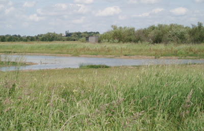
I have forsaken the hills, valleys, and slopes for the water meadows and river banks.
In short, dear reader I have today (27/5) started the Thames Path.
It is the only National Trail that follows the entire length of a river, from its source in rural Gloucestershire to the Thames Barrier in London; the good news is that the topography is reasonably flat; the bad news is that it is 184 miles in length.
It therefore seems unlikely I will endure all those miles, but I would hope to follow its banks, at least as far as Oxford.
At this point I should add that, as with the Cotswold Way I am using the National Trail Guide, this time written by David Sharp , which no doubt I will be referring to in the weeks ahead.
The start point today was Kemble Railway Station, where I parked the car. I made my way as per guide out of the station, looking for a footpath on my right: none appeared. Not, you will agree a good way to begin a walking quest.
In desperation, I rang the Cirencester Tourist Information Centre (number found in trail book ).
It was then that I discovered my error, I had been on the wrong side of the station; in essence I needed an exit from the London bound platform,
Thus once I had crossed the Railway Bridge, all become clear and soon I was in a field and viewing an early sign of the Thames.
which at this time was a dry water bed.
But, within 100 yards of this a trickle of water could be seen.
Shortly after this, in crossing a wooden foot bridge, I spied my first Thames Path acorn sign.
Now, we were cooking.
So it was that, after walking across two large grassy fields, bestrewn with wild flowers, and crossing the busy Fosse Way, I arrived at, glory of glories, the Source of the Thames.
This was put up by the Thames Conservators to confirm this is the commencement of the Trail.
Just in front of this, by an elderly ash tree, are the pebbles of the head spring.
Finally near the stone were the signposts pointed away from the spot; the London journey begins !
In short, dear reader I have today (27/5) started the Thames Path.
It is the only National Trail that follows the entire length of a river, from its source in rural Gloucestershire to the Thames Barrier in London; the good news is that the topography is reasonably flat; the bad news is that it is 184 miles in length.
It therefore seems unlikely I will endure all those miles, but I would hope to follow its banks, at least as far as Oxford.
At this point I should add that, as with the Cotswold Way I am using the National Trail Guide, this time written by David Sharp , which no doubt I will be referring to in the weeks ahead.
The start point today was Kemble Railway Station, where I parked the car. I made my way as per guide out of the station, looking for a footpath on my right: none appeared. Not, you will agree a good way to begin a walking quest.
In desperation, I rang the Cirencester Tourist Information Centre (number found in trail book ).
It was then that I discovered my error, I had been on the wrong side of the station; in essence I needed an exit from the London bound platform,
Thus once I had crossed the Railway Bridge, all become clear and soon I was in a field and viewing an early sign of the Thames.
which at this time was a dry water bed.
But, within 100 yards of this a trickle of water could be seen.
Now, we were cooking.
So it was that, after walking across two large grassy fields, bestrewn with wild flowers, and crossing the busy Fosse Way, I arrived at, glory of glories, the Source of the Thames.
This was put up by the Thames Conservators to confirm this is the commencement of the Trail.
Just in front of this, by an elderly ash tree, are the pebbles of the head spring.
Finally near the stone were the signposts pointed away from the spot; the London journey begins !
Ciao4now
Ck.


Comments
Post a Comment
please feel free to comment and point out faults.
glad to have you aboard .
Curlykale.