Posts

Showing posts from July, 2010

National Trust gets the Tweetment!

Image
Pitched up at Tyntesfield; a Victorian house;  took a roof walk. In black and white garden in  The Courts ; an antidote to the blues. Now at Chalfield Manor , looking at garden, viewing DVD. Upton House , dripping with freshness; vertical borders caress limpid pond with lily ponds. Newark Park:  beautiful vista unchanged in outlook; verdant with promise; A cotswold way enjoiner. Jacob sheep and fallow deer kept in by green oak fence at  Charlecote Park . Ciao4now Ck. NP.  music by the "Fleet Foxes "; forgotten how good this 'alt-folk ' are.

Bye Bye Lakes; Hello Meadows

Image
So there we have it, the first leg of the  Thames Path  completed, from the Source, near Kemble to Cricklade, only 172 miles to the   Thames Barrier. Thus, I bade farewell to the lakes of the water park and reached the meadow lands. The Lakes were looking serene and peaceful today; only the occasional flying swoop of the water fowl, broke this still interlude. As I left Manorbrook Lake, the path  became a gravel track, winding in a skirting exercise around Cleveland Lake and in so doing giving only tantalizing glimpses of water landscape through barbed wire fences. It proved a frustrating experience and generally lowered the enjoyment level of the walk. After this section, it was especially pleasing to spot  the  Thames  again as  I crossed a wooden bridge. As you can see it positively gleamed in a dappled sunlight. I'm pleased to report, that almost from this spot, the walk picked up in interest and soon  the wild flowers protected Elmlea Meadow-lands came into view.

In which I turned right and found an aqueduct

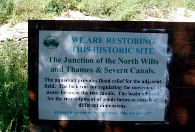
Image
This week's venture took me from Cricklade, back towards the Water Park. I used my bus pass and arrived in Cricklade mid-morning. The view from the double decker bus throughout the journey was a delight, as we moved through Cotswold country to Cirencester and then on past  the lakes to Cricklade. Cricklade, is essentially a  village, with one long High Street. In my Father's day it was always known as a 'watering hole' of note,  with 10 to 12 pubs plying their wares along the street. Well, I'm pleased to inform you that this tradition is still alive, with, counting in a hotel, 5 premises still selling the beer; a heartening sight in these days of recession. The path started at North Wall street at the "bottom" of the High Street. Very quickly the  path  emerged in meadowland, behind the houses and after about half a mile entered the North Meadow Nature Reserve. This ancient meadowland, cut at this time, preserved flowering rarities, such as the yel

New Bits: Cotswold Coda

Image
Above is Dover's Hill, near Chipping Campden; the start/finish of the Cotswold Way. The date 20th June 2010. The time C.12:50am The occasion: the finishing few miles of the attempted running of the  Cotswold Way  from Bath in under 24 hours. Would, that I could show you a picture of a runner  flying by; but alas it was not to be; so having read the 'paper, I made my way back home. However, it was only a few weeks later that, surfing the web, I found that this feat had been achieved, by one Mike Wood, a Cheltenham based athlete; who at 9:00 on 30th April 2010 from Chipping Camden covered the 100+ miles to Bath in an official time of 23 hours 48 mins. and 7 seconds and in so doing became a record holder and raised a good sum of money for the Cystic Fibrosis Trust. Well done Mike! Full story at: ttp://www.nationaltrail.co.uk/Cotswold/article.asp?PageId=41&ArticleId=60 Saw The World Cup Final; last night in 3D at the local cinema. It was an interesting experienc

You Dig: I'll Pour

Image
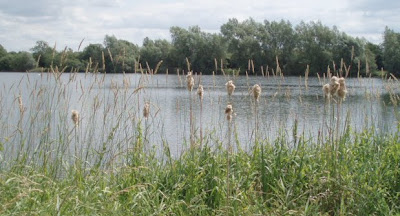
Manorbrook Lake The Cotswold Water Park, is set in over 40 square miles of Cotswold Countryside, with 147 lakes created entirely by gravel extraction. This process has been happening over the last fifty years. The high ground water levels mean that any hole dug more than a metre deep, rapidly begins to fill up. Thus the first fields were dug up wet; using drag lines; creating lakes with uneven bottoms and irregular shore lines. Since 1970s, new pump technology allowed quarries to be dug 'dry'; allowing the creation of deeper lakes and uniform bottoms. A biodiversity action plan 1997 - 2007, has encouraged the creation of lakes with shallow sloping banks, indented shorelines, reed beds and shallow wetlands. It is amazingly, the largest inland  person-made waterway in Europe and not surprisingly submerges the infant Thames. For further information use the following link: http://www.waterpark.org/ I set off on the path  from the village of Ashton Keynes, soon meeting the fo